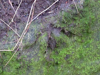
The Ordnance Survey list has just 1 Benchmark in grid SE1947, which is a Pivot Mark – a Pivot mark being one on the side of a protruding stone where the top surface of the stone replaces the horizontal top line of a Cut mark.
1 – PIVOT – PIVOT CUL 31.4M NW HEDGE JUNC NE SIDE RD
FOUND IN GOOD CONDITION
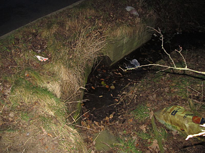
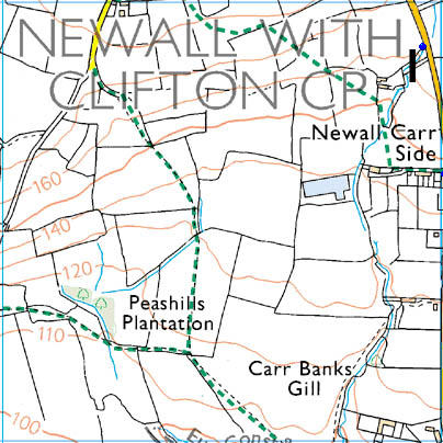
The Pivot is in the Culvert on the North East side of the road, 34.4Mtrs North West of the Hedge Junction
The description of the Pivot goes on to say that it is at a height of -0.5mtrs above ground… or 0.5mtrs below ground, so when I saw the stream running across the road I knew to look on the oldest stones where the culvert goes under the road. There was a lot of moss on the stone, so I had to scrape some of it away to reveal the shape of the mark