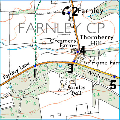
The Ordnance Survey list has 5 Benchmarks in grid SE2147, all of which are normal Cut Marks
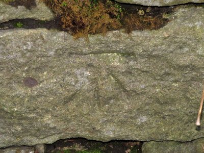
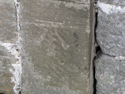
1 – CUT MARK – WALL SE SIDE FARNLEY LANE 2.0M E PRODN HEDGE OPP NW FACE
FOUND IN GOOD CONDITION
Which translates to on the North West face of the wall on the South-East side of Farnley Lane, 2 meters East of the point you would get by projecting the hedge line on the opposite side of the road…
I had no problem finding the Cut Mark, though I did have to use a stick to scrape some of the mud out of the cuts as it is very low down.
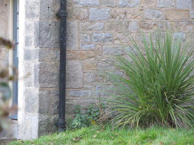
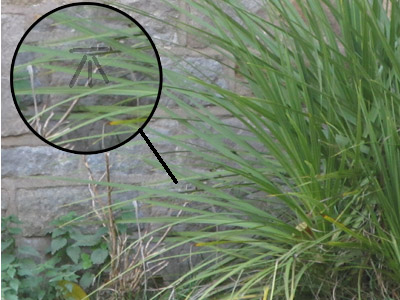
2 – CUT MARK – THE OLD POST OFFICE NE FACE 1.1M E ANG
EXISTENCE NOT CONFIRMED
Which translates to on the North East face of the Old Post Office, 1.1m from the East corner.
The Old Post Office is now a Private House with a closed gate, I took a photo of the wall with my camera on full zoom, and I think I can make out the cut mark behind the plant, at least I can make out marks which don’t appear to be related to the vegetation, so I have shown where I think they are and traced over them to indicate where I think the cut mark is – though this may be just my imagination, I can’t actually confirm that the cut mark still exists.
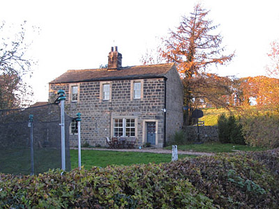
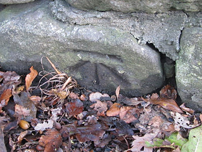
3 – CUT MARK – ROADSIDE COTTAGE THE SQUARE NW FACE W ANG
FOUND IN GOOD CONDITION
Just outside the gates of Farnley Hall is ‘The Square’ a square block of what used to be estate workers cottages, barns, farm sheds etc… all now posh houses, so the translation of North West face of the Roadside Cottage of The Square, at the West corner makes sense, and the cut mark was another easy find.
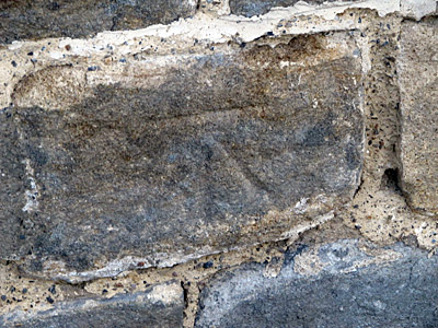
4 – CUT MARK – HO CREAMERY FM E FACE 3.3M S NE ANG
FOUND IN GOOD CONDITION
This translates to 3.3mtrs south of the North East corner of the Eastern face of a house, ‘Creamery Farm’ (I’m presuming the building used to be the creamery for the Farnley estate)
Easy to find with such prescriptive directions, the cut mark shows up much better with the naked eye than it does in the photograph.
5 – CUT MARK – WALL 56.6M NW JUNC FENCE OPP SW SIDE FARNLEY PARK RD NE FACE
FOUND IN GOOD CONDITION
North East face of the wall on the South West side of Farnley Park Road, 56.6mtrs north west of the fence junction on the opposite side of the road…
This was probably the hardest of the five to spot (allowing for the fact that I didn’t ‘spot’ no.2, I just fired off a snapshot), the wall is on a roadside verge and has plenty of ivy, moss, nettles and other vegetation growing on / up / around it and I didn’t have a long tape measure to measure 56.6mtrs from the fence junction in the field opposite – not that there is a fence junction there anymore as the farmer has changed the access into the field and removed the fence. However, a bit of perseverance and I found the mark… again it doesn’t show up too well in the photograph.